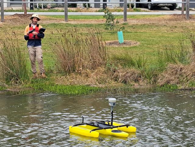
The Barwon Heads Road Upgrade is going to new depths using a drone boat to gather subsurface information from surrounding waterways.
The boat’s sonar technology has mapped depths and submerged contours of waterways in the project area, with the data used to help with flood modelling.
Major Road Projects Victoria acting program director Damian Van Dyke said the boat made it safer and more effective in mapping submerged areas and identifying infrastructure upgrades.
“The drone boat offers safer and easier access for site surveys as we continue our planning work on the next stage of the Barwon Heads Road upgrade,” he said.
“The drone boat also supports our efforts to work with our design and survey partners to adopt the latest innovations and technology as we continue working on this important project for the local community.”
The drone vessel’s benefits included transport savings, storage and maintenance costs, and reduced environmental impacts.
The TriDrone boat’s contractor, SMEC Australia, deployed the boat in sections of Armstrong Creek as part of its surveying work.
Urban communities Geelong survey team leader Sam Lovelock said he was pleased to help with the upgrade’s second stage with the unmanned surface vehicle.
“The TriDrone is a great new tool in our arsenal of survey technology to conduct work safely and efficiently,” he said.
“Importantly, it also allows us to provide previously unattainable information that can be vital to planning for projects like the Barwon Heads Road upgrade.”
The project’s potential scope included adding lanes, upgrading intersections, and building shared walking and cycling paths.
Visit bigbuild.vic.gov.au/projects/mrpv/barwon-heads-road-upgrade/stage-2 for more information about stage two of the Barwon Heads Road Upgrade.