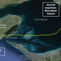
THE Australian Transport Safety Bureau (ATSB) last week released the flightpath of the airplane which crashed off the coast of Point Lonsdale on 29 January.
An ATSB investigation, which is still active, revealed the plane hit the water just 200m from a witness, who was fishing about 3km off the coast.
The witness saw the light aircraft descend out of clouds in a steep, nose-down dive, with the right wing lower than the left, an ATSB report said.
The Piper aircraft PA-28-235 took off from Moorabbin Airport T 12.03pm and was travelling to King Island Airport in Tasmania.
There were four people on board the privately-owned plane, three of whom were private pilots. Two were members of the Royal Victorian Aero Club.
At this stage, investigators have not established who the pilot was.
Other aircraft from the same aero club were also flying to King Island over the course of the afternoon.
Recorded air traffic control (ATC) data indicated that the aircraft climbed to 300m then turned south-west near Seaford.
The aircraft then climbed to 430m over Port Phillip Bay, then turned west towards the Bellarine Peninsula.
The ATC data also showed that, after passing over Point Lonsdale, the pilot carried out a series of turns, before a final steepening and a rapidly-descending turn.
Witness reports and ATC data indicated that the aircraft impacted the water at about 12.30pm. The crash killed four people.
A number of witnesses, including other aero club pilots in the area, reported cloud and rain reduced visibility between Barwon Heads and Point Lonsdale.
Wreckage examination indicated that the aircraft’s fuselage and associated components were subjected to high impact forces and subsequently failed in overload.
Investigators have not found aircraft’s wings but have found several of aircraft components, including the engine and propeller.
Weather a factor in plane crash
Digital Editions


-
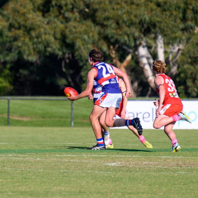
Unbeaten Grove…still
Purchase this photo from Pic Store: 476564 Ocean Grove thrashed an injury-hit Queenscliff to keep its undefeated Bellarine Netball League season intact on Saturday. After…